
This guide aims to aid salt marsh-upland ecotone restoration by providing a list of 24 key species and the elevations at which they should be planted in restoration projects. It is intended for restoration practitioners, land and natural resource managers that are interested in coastal restoration, and coastal landowners interested in erosion prevention and residential restoration projects such as living shorelines. Some example uses include living shorelines and facilitating marsh migration into uplands in the face of sea level rise.
Introduction
In this publication, we present a sample of Florida salt marsh-upland ecotone species and their elevation tolerances. The goal of this project was to inform ecotone restoration by determining optimum conditions for planting key Florida salt marsh-upland ecotone species, giving restoration practitioners tools to include ecotone species in salt marsh restoration projects. This guide is intended for restoration practitioners and land managers who are interested in coastal restoration. It may also be useful for coastal landowners to aid in erosion prevention and residential marsh restoration/living shorelines.

Credit: Emory Wellman, UF/IFAS.
Background
Salt marshes in Florida are critical ecosystems that provide flood and hurricane protection, filter water, act as habitat for important and endangered species, capture carbon, and facilitate recreational activities such as fishing (Teal and Howes 2000). Restoring these ecosystems is common practice in Florida, but restoration is complicated, and current restoration methods are not perfect. Salt marsh restoration in Florida often relies on planting one or a small handful of species. This approach could be a problem because salt marshes naturally feature a variety of species, and species diversity aids restoration efforts (Callaway 2005). Additionally, salt marshes feature different species in areas with different degrees of flooding (Figure 2), so it’s rare for one species to thrive in all parts of the marsh (Cui et al. 2011).
One area underrepresented in Florida salt marsh restoration is the salt marsh-upland ecotone. In any type of environment, the ecotone is the zone of transition between one ecosystem type and another. They generally occur over a narrow band and feature unique conditions and species (Attrill and Rundle 2002). The upland ecotone of a salt marsh is the area at the inland border immediately next to the high marsh, where the high marsh grows into the terrestrial zone and flooding is less frequent than in the rest of the marsh due to higher elevations, lessening salinity. On the salt marsh side, the species present are mainly determined by physical forces. The plants that can survive there are ones that can handle the harsh conditions of high salinity and frequent flooding (Callaway 2005; James and Zedler 2000). Upland ecotone species do not move down into the marsh because they are not able to handle these stressful conditions. On the upland side, the species present are mainly determined by competition and facilitation, negative and positive interactions with neighboring plants (Cui et al. 2011; James and Zedler 2000). Upland species are often not as adapted to dealing with the periodic flooding and higher salinity present in the ecotone, but ecotone species lose this competitive advantage in higher elevation upland environments (James and Zedler 2000). Essentially, ecotone species are the ones that can outcompete other plants in areas of infrequent flooding and intermediate salinity.
Salt marsh-upland ecotones are ecologically important. They aid and filter the transfer of materials, organisms, and nutrients between ecosystems; support diverse animal and plant communities; and prevent erosion (Kark 2012). These ecotones are threatened, increasingly so in a changing climate. While restoration of salt marsh ecotones is increasingly common on the west coast of the United States and has been done in northern areas of the Atlantic coast, it appears to be mostly ignored in Florida. The goal of this project was to support ecotone restoration by determining optimum conditions for planting key Florida salt marsh-upland ecotone species.

Credit: Diagram from UF/IFAS Extension's Florida Wetlands Extension Program at soils.ifas.ufl.edu.
Use
This guide should be used to determine where to plant these ecotone species when practicing salt marsh restoration. Before planting any of the species listed in this guide in the ecotone of a restoration project, it’s important to carefully consider the upland community. The upland system impacts which species grow in the ecotone because much of the ecotone community is a mixture of marsh and upland species. This guide contains a sample of species occurring in a variety of salt marsh-upland ecotones but is not intended to be an exhaustive list. Only species occurring in the ecotone itself were included, and tree species were avoided as they were considered too slow-growing to be viable for initial restoration. This guide is intended for early steps of the restoration process, and it therefore targets pioneer species. Other species may be planted or may naturally relocate to the ecotone after the land is stabilized by the species included in this guide. The community types listed for each species in the guide can be used to inform which would be best suited for your restoration project.
The guide provides a description of each species along with a summary of the elevations at which the plant is found throughout Florida. The graphs and tables show the range of elevations that each species can tolerate and the elevation at which they are most commonly found. We suggest contacting local nurseries to find out what plants they have available and the capacity of each nursery to propagate in quantities necessary for your restoration project. The specific conditions at your restoration project will be unique. The elevation recommendations in the guide are a starting point, but experimentation and pilot plantings may be necessary to determine the exact elevations for each plant that ensure the highest rate of success.
Methods
This project developed a list of important salt marsh-upland species from the combination of several sources. These include a short list of ecotone species in a Mississippi salt marsh created by another ecotone researcher (Anderson et al. 2022), a source detailing species in different parts of a salt marsh published by the Virginia Institute of Marine Sciences (Living Shorelines n.d.), information synthesized from the Florida Natural Areas Inventory (FNAI) (FNA Inventory 1990), lists of high marsh plants published by FloridaLivingShorelines.com, and recommendations by UF/IFAS experts on key species that were missing from the FNAI list. Plants were chosen if they were found in the ecotone in Florida. It is important to note that these species do not necessarily grow exclusively in the ecotone and may be found in other systems. We defined ecotone species as plants that were neither obligate wetland nor obligate upland species, had some level of salt tolerance, and were either listed as salt marsh-upland ecotone species by one of the previously listed sources or were listed by the FNAI as growing both in salt marshes and in upland habitats. We chose a subset of species as a sample of salt marsh-upland ecotone plants in Florida. For questions about methods and selection criteria of species contact alsiegel@vims.edu.
We obtained species location data from iNaturalist (Figure 3), a smartphone application that allows users to identify and document plants they find (iNaturalist.org). Elevations for each plant’s location were then determined using elevation data from the National Elevation Dataset published by the United States Geological Survey, which uses meters and the North American Vertical Datum of 1988 (NAVD88) as the vertical datum (Gesch et al. 2018). A vertical datum is a reference to determine relative elevation, similar to saying feet above sea level. Meters NAVD88 describes how many meters above or below a theoretical reference determined by the National Geodetic Survey. We used these data to characterize the elevation tolerances of each species within the entire state of Florida. We used the Florida Cooperative Land Cover Map (FNA Inventory 2010) to filter the data to include only species growing in salt marshes or in systems that directly border salt marshes. This allowed us to obtain a better estimate of only individuals growing in the salt marsh-upland ecotone.
Data processing was done in ArcGIS Pro, RStudio, and Microsoft Excel. Pictures came from the Atlas for Florida Plants and iNaturalist observations under the public domain (CC0).
Our analysis delivered a list of 24 ecotone species and information on their elevation tolerances that can be used to inform future research and allow the inclusion of ecotone species in future salt marsh restoration projects.

Credit: Ari Siegel, UF/IFAS.
Plant List
- Acrostichum aureum
- Andropogon glomeratus
- Baccharis angustifolia
- Baccharis halimifolia
- Batis maritima
- Borrichia frutescens
- Cynanchum angustifolium
- Distichlis spicata
- Fimbristylis cymosa
- Flaveria linearis
- Ipomoea sagittata
- Iva frutescens
- Limonium carolinianum
- Lycium carolinianum
- Morella cerifera
- Muhlenbergia capillaris
- Pluchea odorata
- Sesuvium portulacastrum
- Solidago sempervirens
- Sporobolus bakeri (Spartina bakeri)
- Sporobolus pumilus (Spartina patens)
- Sporobolus virginicus
- Symphyotrichum tenuifolium
- Yucca aloifolia
All Plant Data Summarized
This data represents the general location of the salt marsh-upland ecotone in Florida, although the exact elevation range of this ecotone may vary regionally. It was created by combining the final filtered data from all 24 species and provides a summary of the elevations at which Florida ecotone plants can be found.Elevation in Meters, Summary of Data for All 24 Species
Minimum: −1.500 1st Quartile: 0.440 Median: 0.770 Mean: 0.834 3rd Quartile: 1.070 Maximum: 11.360

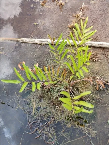
Achrostichum aureum
Acrostichum aureum (golden leather fern) is a fern species found in salt marshes and mangrove swamps. This is a large plant with fronds growing up to six feet tall. It is widespread and not threatened.
Where to Plant Acrostichum aureum
Acrostichum aureum should be planted in the salt marsh ecotone between −0.19 and 0.15 meters NAVD88 for best results. It can survive at higher elevations but should not be planted any lower than this range.
Below we provide more detail on where Acrostichum aureum plants have been found in and near salt marshes.
Elevation in Meters
- Minimum: −1.500
- First Quartile: −0.190
- Median: 0.000
- Mean: −0.108
- Third Quartile: 0.150
- Maximum: 1.370


Credit: iNaturalist, CC0

Andropogon glomeratus
Andropogon glomeratus (bushy bluestem) is a grass species found in salt marshes, glades marshes, and coastal grassland habitats. This grass grows up to six feet high and has blue-green leaves in summer. It is widespread throughout the Americas and is a potential invasive species outside of its native range.
Where to plant Andropogon glomeratus
Andropogon glomeratus should be planted in the salt marsh ecotone between 0.880 and 1.650 meters NAVD88 for best results. It can survive at significantly higher or significantly lower elevations.
Below we provide more detail on where Andropogon glomeratus plants have been found in and near salt marshes.
Elevation in Meters
Minimum: 0.220 First Quartile: 0.880Median: 1.140Mean: 1.425Third Quartile: 1.650Maximum: 5.460


Baccharis angustifolia
Baccharis angustifolia (saltwater falsewillow) is a shrub species found in salt marshes and sand dunes. It can grow up to thirteen feet and has narrow leaves. It is native to the United States Southeast.
Where to plant Baccharis angustifolia
Baccharis angustifolia should be planted in the salt marsh ecotone between 0.465 and 0.965 meters NAVD88 for best results. It can survive at slightly higher and lower elevations.
Below we provide more detail on where Baccharis angustifolia plants have been found in and near salt marshes.
Elevation in Meters
Minimum: −0.1501st Quartile: 0.465Median: 0.760Mean: 0.7203rd Quartile: 0.965Maximum: 1.790


Baccharis halimifolia
Baccharis halimifolia (groundsel tree/sea myrtle) is a shrub/tree species found in salt marshes and other wetlands. It grows up to twelve feet high and has white flowers. It is native to parts of the Americas.
Where to plant Baccharis halimifolia
Baccharis halimifolia should be planted in the salt marsh ecotone between 0.620 and 1.335 meters NAVD88 for best results. It can survive at higher elevations but should not be planted much lower than this range.
Below we provide more detail on where Baccharis halimifolia plants have been found in and near salt marshes.
Elevation in Meters
Minimum: −0.8701st Quartile: 0.620Median: 0.930Mean: 1.0453rd Quartile: 1.335Maximum: 11.360


Batis maritima
Batis maritima (saltwort) is a succulent scrub species found in salt marshes and mangrove swamps. It grows in dense colonies and can reach from between a few inches high to five feet tall. It is edible and native to the East and West Coasts of the Americas.
Where to plant Batis maritima
Batis maritima should be planted in the salt marsh ecotone between 0.250 and 0.675 meters NAVD88 for best results. It can survive at slightly higher and lower elevations, but the majority lives in this range.
Below we provide more detail on where Batis maritima plants have been found in and near salt marshes.
Elevation in Meters
Minimum: −0.9401st Quartile: 0.250Median: 0.440Mean: 0.4623rd Quartile: 0.675Maximum: 2.330


Borrichia frutescens
Borrichia frutescens (bushy seaside oxeye) is an herb/shrub species found in salt marshes, mangrove swamps, and coastal berms. It grows up to three feet high and can attract butterflies. It is native to the United States and Mexico.
Where to plant Borrichia frutescens
Borrichia frutescens should be planted in the salt marsh ecotone between 0.318 and 0.863 meters NAVD88 for best results. Some plants survive at higher and slightly lower elevations, but most live in this narrow range.
Below we provide more detail on where Borrichia frutescens plants have been found in and near salt marshes.
Elevation in Meters
Minimum: −1.2501st Quartile: 0.318Median: 0.590Mean: 0.6143rd Quartile: 0.863Maximum: 6.100


Cynanchum angustifolium
Cynanchum angustifolium, or Pattalias palustre (gulf coast swallowwort/vine milkweed) is a vine species found in salt marsh, coastal hammock, and sand dune habitats. It can grow up to ten feet long and supports monarch butterflies. It is native to the United States Atlantic and Gulf coasts.
Where to plant Cynanchum angustifolium
Cynanchum angustifolium should be planted in the salt marsh ecotone between 0.610 and 1.030 meters NAVD88 for best results. It should not be planted much outside of this range.
Below we provide more detail on where Cynanchum angustifolium plants have been found in and near salt marshes.
Elevation in Meters
Minimum: −0.4501st Quartile: 0.610Median: 0.800Mean: 0.7913rd Quartile: 1.030Maximum: 1.550


Distichlis spicata
Distichlis spicata (saltgrass) is a grass species found in salt marshes, mangrove swamps, coastal berms, and glades marshes. It is generally short but can reach up to one and a half feet high and often grows in dense clumps. It is native to the Americas.
Where to plant Distichlis spicata
Distichlis spicata should be planted in the salt marsh ecotone between 0.450 and 1.043 meters NAVD88 for best results. Some specimens can survive above this range, but it should not be planted any lower.
Below we provide more detail on where Distichlis spicata plants have been found in and near salt marshes.
Elevation in Meters
Minimum: −1.5001st Quartile: 0.450Median: 0.680Mean: 0.7083rd Quartile: 1.043Maximum: 2.580


Fimbristylis cymosa
Fimbristylis cymosa (hurricanegrass) is a sedge species found in salt marshes and mangrove swamps. It can grow up to two feet high, and it is naturalized in Florida. The first documented collection in Florida was in the 1930s, and it has since spread over much of the state. It is native to much of the Americas and Australia, and it may be introduced in Florida.
Where to plant Fimbristylis cymosa
Fimbristylis cymosa should be planted in the salt marsh ecotone between 0.500 and 1.090 meters NAVD88 for best results. It can survive at higher and slightly lower elevations.
Below we provide more detail on where Fimbristylis cymosa plants have been found in and near salt marshes.
Elevation in Meters
Minimum: −0.3901st Quartile: 0.500Median: 0.700Mean: 0.8213rd Quartile: 1.090Maximum: 2.810


Flaveria linearis
Flaveria linearis (narrowleaf yellowtops) is an herb species found in salt marshes and marl prairies. It can grow up to two and a half feet high and has long, narrow leaves. It is native to parts of North America and the Caribbean.
Where to plant Flaveria linearis
Flaveria linearis should be planted in the salt marsh ecotone between 0.605 and 1.328 meters NAVD88 for best results. It can survive at a few meters higher elevation, but it should not be planted any lower than this range.
Below we provide more detail on where Flaveria linearis plants have been found in and near salt marshes.
Elevation in Meters
Minimum: −0.4901st Quartile: 0.605Median: 0.875Mean: 0.9073rd Quartile: 1.328Maximum: 2.040


Ipomoea sagittata
Ipomoea sagittata (saltmarsh morning-glory) is a vine species found in salt marshes, glades marshes, and hammocks. It is a climbing vine with pink or purple flowers. It is native to the United States southeast, Mexico, and the Caribbean.
Where to plant Ipomoea sagittata
Ipomoea sagittata should be planted in the salt marsh ecotone between 0.660 and 1.065 meters NAVD88 for best results. Some individual plants can survive a few meters higher, but the majority lives in this range.
Below we provide more detail on where Ipomoea sagittata plants have been found in and near salt marshes.
Elevation in Meters
Minimum: −1.2501st Quartile: 0.660Median: 0.840Mean: 0.8793rd Quartile: 1.065Maximum: 3.100


Iva frutescens
Iva frutescens (bigleaf sumpweed) is a subshrub/shrub species found in salt marsh, beach dune, and salt panne habitats. It can grow almost twelve feet tall and is not very flood tolerant. It is native to the East coast of North America and the Gulf coast of the United States.
Where to plant Iva frutescens
Iva frutescens should be planted in the salt marsh ecotone between 0.525 and 0.933 meters NAVD88 for best results. It should not be planted outside of this range.
Below we provide more detail on where Iva frutescens plants have been found in and near salt marshes.
Elevation in Meters
Minimum: −0.6101st Quartile: 0.525Median: 0.700Mean: 0.7113rd Quartile: 0.933Maximum: 1.820

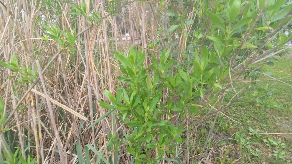

Limonium carolinianum
Limonium carolinianum (carolina sealavender) is an herb species found in salt marshes and mangrove swamps. It grows one to two feet high and is often used in flower arrangements. It is native to the East coast of North America.
Where to plant Limonium carolinianum
Limonium carolinianum should be planted in the salt marsh ecotone between 0.460 and 0.900 meters NAVD88 for best results. It can survive at elevations slightly higher than this range but should not be planted any lower.
Below we provide more detail on where Limonium carolinianum plants have been found in and near salt marshes.
Elevation in Meters
Minimum: −0.7701st Quartile: 0.460Median: 0.650Mean: 0.6663rd Quartile: 0.900Maximum: 1.500


Lycium carolinianum
Lycium carolinianum (christmasberry/carolina desert-thorn) is a succulent shrub species found in salt marshes and mangrove swamps. It produces small, edible fruits, but may be mistaken for other species whose fruits are not. It is native to the United States.
Where to plant Lycium carolinianum
Lycium carolinianum should be planted in the salt marsh ecotone between 0.385 and 0.950 meters NAVD88 for best results. Some plants survive at higher elevations, but the majority is found in this range.
Below we provide more detail on where Lycium carolinianum plants have been found in and near salt marshes.
Elevation in Meters
Minimum: −1.2501st Quartile: 0.385Median: 0.650Mean: 0.6593rd Quartile: 0.950Maximum: 2.430

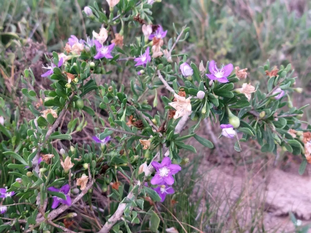

Morella cerifera
Morella cerifera (southern bayberry/wax myrtle) is a tree/shrub species found in salt marshes and other marshes and in hammock habitats. It can grow up to 46 feet high, and the wax that gives it its common name can be used to make candles. It is native to North and Central America as well as the Caribbean.
Where to plant Morella cerifera
Morella cerifera should be planted in the salt marsh ecotone between 0.848 and 1.693 meters NAVD88 for best results. It often grows at higher elevations but should not be planted any lower than this range.
Below we provide more detail on where Morella cerifera plants have been found in and near salt marshes.
Elevation in Meters
Minimum: −0.5501st Quartile: 0.848Median: 1.120Mean: 1.4063rd Quartile: 1.693Maximum: 7.150


Muhlenbergia capillaris
Muhlenbergia capillaris (muhly grass) is a grass species found in salt marshes. It can grow up to four feet high and turns pink in the fall. It is native to the United States, Mexico, and parts of Central America.
Where to plant Muhlenbergia capillaris
Muhlenbergia capillaris should be planted in the salt marsh ecotone between 0.875 and 1.450 meters NAVD88 for best results. It can survive at slightly higher and lower elevations but should not be planted much outside of this range.
Below we provide more detail on where Muhlenbergia capillaris plants have been found in and near salt marshes.
Elevation in Meters
Minimum: 0.0001st Quartile: 0.875Median: 1.010Mean: 1.5303rd Quartile: 1.450Maximum: 6.910


Pluchea odorata
Pluchea odorata (sweetscent) is a subshrub species found in salt marshes and glades marshes. It can grow up to six feet high and is used to make a medicinal tea in some areas. It is native to much of the Americas including the Caribbean.
Where to plant Pluchea odorata
Pluchea odorata should be planted in the salt marsh ecotone between 0.550 and 0.978 meters NAVD88 for best results. It can survive at significantly higher elevations but should not be planted below this range.
Below we provide more detail on where Pluchea odorata plants have been found in and near salt marshes.
Elevation in Meters
Minimum: −0.4601st Quartile: 0.550Median: 0.765Mean: 0.8193rd Quartile: 0.978Maximum: 2.960


Sesuvium portulacastrum
Sesuvium portulacastrum (shoreline seapurslane) is an herb species found in salt marshes, mangrove swamps, coastal berms, and glade marshes. It grows up to one foot tall and has long horizontal stems. It is native to much of the world.
Where to plant Sesuvium portulacastrum
Sesuvium portulacastrum should be planted in the salt marsh ecotone between 0.300 and 1.000 meters NAVD88 for best results. Much survives a little lower and a little higher than this range.
Below we provide more detail on where Sesuvium portulacastrum plants have been found in and near salt marshes.
Elevation in Meters
Minimum: −1.4401st Quartile: 0.300Median: 0.630Mean: 0.6633rd Quartile: 1.000Maximum: 3.810


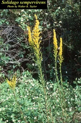
Solidago sempervirens
Solidago sempervirens (seaside goldenrod) is a forb species found in salt marsh, sand dune, and salt panne habitats. It can grow up to eight feet high and is a succulent species that is currently expanding inland along roadsides. It is native to the United States Atlantic coast and parts of the Caribbean.
Where to plant Solidago sempervirens:
Solidago sempervirens should be planted in the salt marsh ecotone between 0.615 and 1.145 meters NAVD88 for best results. It can survive at higher elevations but should not be planted below this range.
Solidago sempervirens elevations:
Below we provide more detail on where Solidago sempervirens plants have been found in and near salt marshes.
Elevation in Meters
Minimum: −0.6101st Quartile: 0.615Median: 0.900Mean: 0.8673rd Quartile: 1.145Maximum: 2.320


Sporobolus bakeri (Spartina bakeri)
Sporobolus bakeri (sand cordgrass), previously known as Spartina bakeri, is a grass species found in salt marshes, marl prairies, and other coastal as well freshwater habitats. It grows up to four feet tall and forms dense bunches. It is native to the United States Southeast.
Where to plant Sporobolus bakeri
Sporobolus bakeri should be planted in the salt marsh ecotone between 0.675 and 1.058 meters NAVD88 for best results. It can survive at significantly higher elevations but should not be planted below this range.
Below we provide more detail on where Sporobolus bakeri plants have been found in and near salt marshes.
Elevation in Meters
Minimum: 0.1801st Quartile: 0.675Median: 0.790Mean: 0.9773rd Quartile: 1.058Maximum: 5.330


Sporobolus pumilus (Spartina patens)
Sporobolus pumilus (saltmeadow cordgrass/marshhay cordgrass), previously known as Spartina patens, is a grass species found in salt marshes, beach dunes, coastal grasslands, and glades marshes. It grows up to two feet tall in thick mats and is critical to salt marsh health in its native range. It is native to the Atlantic Coast of North America and parts of the Carribean.
Where to plant Sporobolus pumilus
Sporobolus pumilus should be planted in the salt marsh ecotone between 0.345 and 0.983 meters NAVD88 for best results. It is not often found outside this range.
Below we provide more detail on where Sporobolus pumilus plants have been found in and near salt marshes.
Elevation in Meters
Minimum: −0.5101st Quartile: 0.345Median: 0.665Mean: 0.6123rd Quartile: 0.983Maximum: 1.510


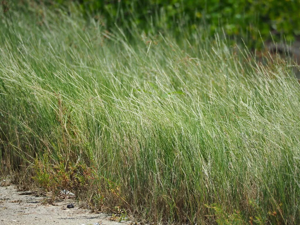
Sporobolus virginicus
Sporobolus virginicus (seashore dropseed) is a grass species found in salt marshes, mangrove swamps, beach dunes, and coastal berms. It grows up to one and a half feet tall and has green or purple flowers. It is native to much of the world.
Where to plant Sporobolus virginicus
Sporobolus virginicus should be planted in the salt marsh ecotone between 0.765 and 1.140 meters NAVD88 for best results. It can grow a little above and below this range.
Below we provide more detail on where Sporobolus virginicus plants have been found in and near salt marshes.
Elevation in Meters
Minimum: 0.1301st Quartile: 0.765Median: 0.960Mean: 1.0373rd Quartile: 1.140Maximum: 2.360


Symphyotrichum tenuifolium
Symphyotrichum tenuifolium (perennial saltmarsh aster) is a shrub species found in salt marshes, glades marshes, slough marshes, and upland pine habitat. It can grow to about three feet high and has white yellow or purple flowers. It is native to the United States and parts of the Caribbean.
Where to plant Symphyotrichum tenuifolium
Symphyotrichum tenuifolium should be planted in the salt marsh ecotone between 0.100 and 0.985 meters NAVD88 for best results. It can survive at slightly higher elevations.
Below we provide more detail on where Symphyotrichum tenuifolium plants have been found in and near salt marshes.
Elevation in Meters
Minimum: −0.7701st Quartile: 0.100Median: 0.565Mean: 0.5673rd Quartile: 0.985Maximum: 1.880


Yucca aloifolia
Yucca aloifolia (Spanish bayonet/aloe yucca) is a tree/shrub species found in salt marshes and beach habitats like dunes. It can grow up to twenty feet high and has thick evergreen leaves. It is native to the United States Atlantic and Gulf Coasts, Mexico, and parts of the Caribbean.
Where to plant Yucca aloifolia
Yucca aloifolia should be planted in the salt marsh ecotone between 0.660 and 1.560 meters NAVD88 for best results. It can survive at higher elevations and slightly below this range.
Below we provide more detail on where Yucca aloifolia plants have been found in and near salt marshes.
Elevation in Meters
Minimum: −0.2101st Quartile: 0.660Median: 1.130Mean: 1.2343rd Quartile: 1.560Maximum: 5.590


Contact
Anna Braswell, (352 846-0865, a.braswell@ufl.edu
Acknowledgements
This restoration guide was created by UF/IFAS Extension with funding from the Florida Climate Institute, the UF/IFAS School of Forests, Fisheries, and Geomatic Sciences, and the UF/IFAS Florida Sea Grant College Program.
Works Cited
Anderson, C. P., G. A. Carter, and M. C. Waldron. 2022. “Precise Elevation Thresholds Associated With Salt Marsh–Upland Ecotones Along the Mississippi Gulf Coast.” Annals of the American Association of Geographers 112: 1850–1865. doi:10.1080/24694452.2022.2047593.
Attrill, M., and S. Rundle 2002. “Ecotone or Ecocline: Ecological Boundaries in Estuaries.” Estuarine, Coastal and Shelf Science 55: 929–936. doi:10.1006/ecss.2002.1036.
Callaway, J. C. 2005. “The Challenge of Restoring Functioning Salt Marsh Ecosystem.” Journal of Coastal Research, 24–36.
Cui, B.-S., Q. He, and Y. An. 2011. “Community Structure and Abiotic Determinants of Salt Marsh Plant Zonation Vary Across Topographic Gradients.” Estuaries and Coasts 34: 459–469. doi:10.1007/s12237-010-9364-4.
FNA Inventory. 1990. Guide to the Natural Communities of Florida.
FNA Inventory. 2010. Cooperative Land Cover Map (Version 1.1) – July 2010.
Gesch, D. B., G. A. Evans, M. J. Oimoen, and S. Arundel. 2018. The National Elevation Dataset. American Society for Photogrammetry and Remote Sensing.
iNaturalist. Available from https://www.inaturalist.org. Accessed 04/2024
James, M. L., and J. B. Zedler. 2000. “Dynamics of Wetland and Upland Subshrubs at the Salt Marsh–Coastal Sage Scrub Ecotone.” American Midland Naturalist 143:298–311. doi:10.1674/0003-0031(2000)143[0298:DOWAUS]2.0.CO;2.
Kark, S. 2012. “Ecotones and Ecological Gradients,” in Ecological Systems: Selected Entries from the Encyclopedia of Sustainability Science and Technology, edited by R. Leemans. Springer. doi:10.1007/978-1-4614-5755-8_9.
Living Shorelines. 2024. “Wetland Plants Zone.” Virginia Institute of Marine Science. https://ccrm.vims.edu/livingshorelines/ls_wetland_plants_zone.html. Accessed April 2024.
Teal, J. M., and B. L. Howes. 2000. “Salt Marsh Values: Retrospection from the end of the Century.” In Concepts and Controversies in Tidal Marsh Ecology, edited by M. P. Weinstein and D. A. Kreeger. Springer, Dordrecht. doi:10.1007/0-306-47534-0_2.
Wunderlin, R., B. Hansen, A. Franck, and F. Essig. 2021. Atlas of Florida Plants. Institute of Systematic Botany, University of South Florida, Tampa. [SM Landry and KN Campbell (application development), USF Water Institute.] https://florida.plantatlas.usf.edu/.